North Stoneham Park: its origin and development.
Christopher K. Currie, Research Fellow, Gardens Archaeology Project. Fieldwork and research undertaken for the Planning Department, Hampshire County Council, April 1992.
This report looks at the earliest origins of the deer park at North Stoneham. It traces how the park was accommodated into an already existing landscape, dating back to the Saxon period. There are also traces of Roman features within this landscape that may have also influenced its development.
Clues to the early landscape are given in a charter of A. D. 932 for North Stoneham. Support for inferences drawn from this document are given in other Saxon charters for neighbouring estates. These, together with cartographic and topological evidence, indicate that North Stoneham Common had been created as an area of common pasture by at least the middle Saxon period. An old trackway can be traced between the common and a farmstead apparently referred to on one of the charters. A Roman building on the site of this farmstead hints at earlier origins. This trackway was later used as the southern boundary of the medieval deer park.
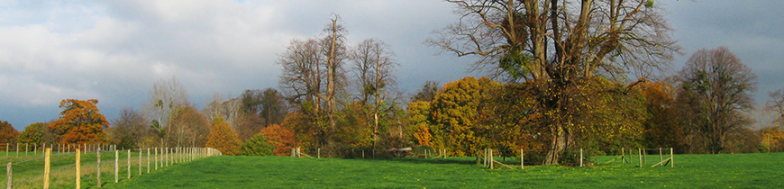
The boundaries of the deer park are traced by fieldwork. These seem to be confirmed by documentary evidence from the sixteenth century as encompassing an area of about 32 hectares (80 acres). The development of the park is traced to the present day, and indicates that it was considerably expanded by the Fleming family after 1599. This expansion continued throughout the eighteenth and early nineteenth centuries.
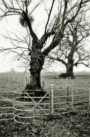
The evidence for a possible 2,000-year continuity of elements within the landscape at North Stoneham is not common in the United Kingdom. Although this landscape has been considerably damaged in the recent past by development, there is still a good case for conservation of the remaining areas. The ability to demonstrate long-term landscape survival and evolution as an educational resource could prove to be valuable, and protection of certain elements in this landscape is recommended.