 |
|
|
|
|
|
|
|
|
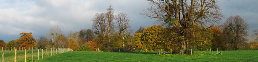
Description of the Study Area - North Stoneham Planning and Management Framework, 19934. BROAD DESCRIPTION OF THE STUDY AREA 4.1 The principal landscape characteristics of the study area are shown on Map 3. They may be divided into the following broad landscape character units (Map 4). PLAYING FIELDS Southampton University and Trojan Club Playing Fields 4.2 The density of the playing fields, the obtrusive screen planting, substantial clubhouse and other recreational buildings have significantly changed the landscape character of this area. Most of the original landscape features within the site have disappeared, including most of the medieval "park pale" and meadow land. Despite this there is an important belt of trees along Stoneham Lane. The motorway boundary (M27) has been fully planted by the Department of Transport under a management agreement, and there is little scope for further work. Some of this land may be lost to a future M27 widening scheme. Jubilee Playing Field 4.3 The Jubilee playing field (Pirelli Sports Ground) and its ancillary facilities are contained within the landscape and therefore do not have the same impact as the Trojan Club playing fields. There are still a number of old hedgerows, remnants of the former field boundaries, and evidence of important landscape features associated with the eighteenth century parkland. 4.4 An effective planting programme to further screen the club house and pavilion is required, and the improvement of the western and southern boundaries would be beneficial. Any further enhancement work in this area must depend on the extent and nature of the golf driving range which has been granted planning permission by Eastleigh Borough Council. The sports pitches lost to the driving range are to be relocated within the site. AC Delco Sportsground and adjoining playing fields 4.5 These playing fields are similar in character to the Jubilee Playing Fields and do not substantially detract from the landscape value of the area, apart from the intensive floodlighting. They contain a number of significant historic landscape features which include hedgerows, tree belts and remnants of the "park pale". 6 4.6 Any significant intensification of the pavilions and other ancillary facilities would be damaging to the appearance of the area. Stoneham Golf Club 4.7 The golf course was laid out at the turn of the nineteenth century and incorporates many of the existing parkland features. The present management regime is in keeping with the parkland character of the landscape and, apart from the club house and car park in the south west corner, there is little ancillary development. The course is privately owned and there is no public access. 4.8 The golf club currently manages its land in a way that is generally sympathetic to the environment. There is a wide range of habitats around the fairways and greens and there are a number of substantial tree belts. Chestnut Avenue Public Open Space 4.9 This area is owned by Eastleigh Borough Council. The area retains a significant number of the original trees. In keeping with its parkland character, the area is intended for informal recreation. This open space is of significant nature conservation interest, although the landscape is in a poor state with many of the trees overmature. 4.10 The remains of "The Shrine", erected as a memorial to a member of the Fleming family killed during the Great War, lie near to Avenue Pond. This structure is of historic interest and acts as a focus within this area of open space. 4.11 If the character of this area is to be retained the existing trees will require attention, and a replanting programme undertaken. Park Farm 4.12 Park Farm and the grounds of former North Stoneham House lie at the core of the study area. The land is in four ownerships and there has been a history of unauthorised uses, some of which have been subject to enforcement action. There are a number of permanently occupied caravans in the vicinity of the farm buildings. A further temporary planning permission has been granted for the continued occupation of four remaining caravans until 30th April 1998. This temporary permission is subject to conditions which require the caravans to be moved if the existing named occupants leave before April 1998. It is also a requirement of the planning permission that all other structures and non-residential caravans within the site must be removed by 22nd July 1993. 4.13 The condition of the fields south of Park Farm has deteriorated in recent years. The original avenue of trees has all but disappeared and there needs to be a replanting programme if the parkland character is to be retained. There is a Tree Preservation Order at Park Farm, covering individual trees, clumps and areas of woodland. If the appearance of the landscape is to be enhanced, the management of the grazing regime needs to be improved. A public footpath from Chestnut Avenue to Stoneham Lane crosses this area. 4.14 Avenue Pond is let to Eastleigh and District Angling Club by the owners of Park Farm. Once an important feature in the landscape, it is now hidden from view by successive belts of screen planting of inappropriate species and surrounded by fencing. Vandalism and trespass hinder the proper management of the area. North Stoneham House 4.15 The gardens of North Stoneham House, demolished in 1939, have a rather neglected appearance. Many of the trees are overmature and natural regeneration has obscured the original layout in many places. Nevertheless, this landscape is a most important feature in views across the strategic gap, and is generally in keeping with the parkland character. 4.16 The grounds and farmyard contain a number of historic features and buildings. The two residential buildings - Park Farmhouse and the Orangery - both retain many of their original features, despite modernisation. The walled garden is an impressive feature, but is in a poor condition in places. Two ornamental ponds were created by damming the stream flowing down from Chilworth Ridge. Both are fished by a local club and remain a reminder of the earlier formal layout of the grounds. St. Nicholas Church 4.17 St. Nicholas Church is located in Stoneham Lane, south of the entrance to Park Farm. The building of medieval origin was extensively rebuilt at the beginning of the seventeenth century. The church tower was a focal point in the original garden design. Its setting is impaired by the state of the car park and storage compound at the rear and by the proximity of the pavilion, floodlights and screen planting on the university playing field. There is an outstanding planning permission for the construction of a church hall on a site behind the church. Woodlands 4.18 Home Wood: This woodland is situated on rising ground alongside the motorway and is an important landscape feature in many distant views. At present the wood is managed by the Forestry Commission. Home Wood is an ancient woodland site largely replanted with conifers but still retaining small pockets of oak, birch, ash and hazel coppice. The main area of landscape and wildlife interest is a narrow band of springline and streamside alder coppice which borders a tributary of the Monks Brook. Although the wood has been intensively managed for commercial purposes, the majority of ancient woodland indicator species are found in this area. 4.19 Although there are no statutory footpaths, the public has been gaining informal access to the wood from Chestnut Avenue, and across the motorway bridge through land at the south-west corner owned by Wessex Regional Health Authority (Fred Woolley House). 4.20 Hardmoor Copse: This woodland lies between the M27 and Stoneham Golf Club to the south of the study area. It is an important landscape feature because it screens the motorway. It also maintains an important visual link with other woodland to the south of the motorway (Hardmoor Plantation). Public access is limited as the wood is in private ownership. Hardmoor Copse is a mixture of coniferous and deciduous woodland which has an understorey of rhododendron and laurel. 4.21 Chestnut Bottom Wood: This woodland lies between the motorway and Stoneham Golf Club, to the west of the study area. It acts as an important screen to the motorway, and it is vital that any changes to its management do not diminish its visual impact. It is privately owned and there is no public access. Chestnut Bottom Wood is former heathland and pasture woodland, now an oak plantation with dense rhododendron scrub as well as gorse scrub on spoil from the M3 motorway. |
|